Instrument Landing System
Uploaded at:
2025-09-09
Size and Formats:
1400x960
SVG, PNG, JPG, WebP
Description:
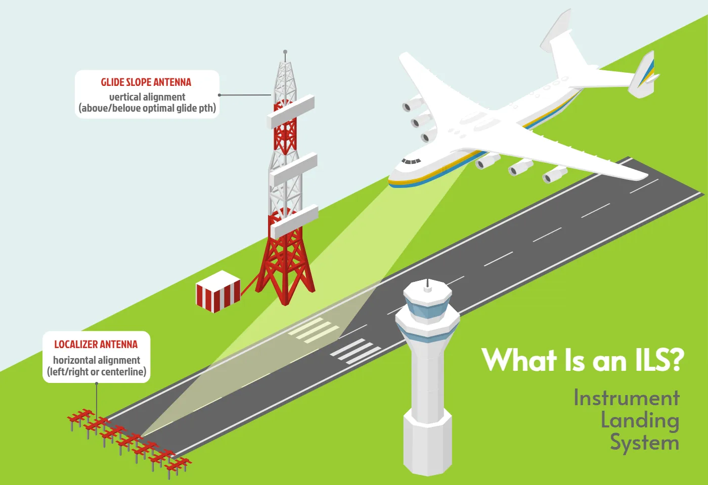
This image is a clear illustration of the Instrument Landing System (ILS) used in aviation. It shows a large airplane approaching a runway, guided by two main antennas. Glide Slope Antenna (on the tall red-and-white tower), which helps pilots with vertical alignment — making sure the aircraft stays on the correct glide path when descending. Localizer Antenna (positioned at the end of the runway), which provides horizontal alignment — keeping the plane centered left or right on the runway approach. The control tower is also visible, emphasizing coordination during landing. This infographic makes it easy to understand how technology supports safe and precise aircraft landings.
